Nel nord-est del Queensland, un rapporto tecnico dedicato ai pesci d’acqua dolce rari e minacciati descrive una pressione ambientale che non dipende da una sola causa. L’analisi ha preso in esame 22 specie dei Wet Tropics australiani e ha valutato il peso di cambiamento climatico, alterazioni del territorio, specie invasive, eventi estremi e modifiche dei corsi d’acqua. Il risultato è un quadro di vulnerabilità concentrata soprattutto nelle popolazioni con distribuzione ridotta e habitat molto specifici.
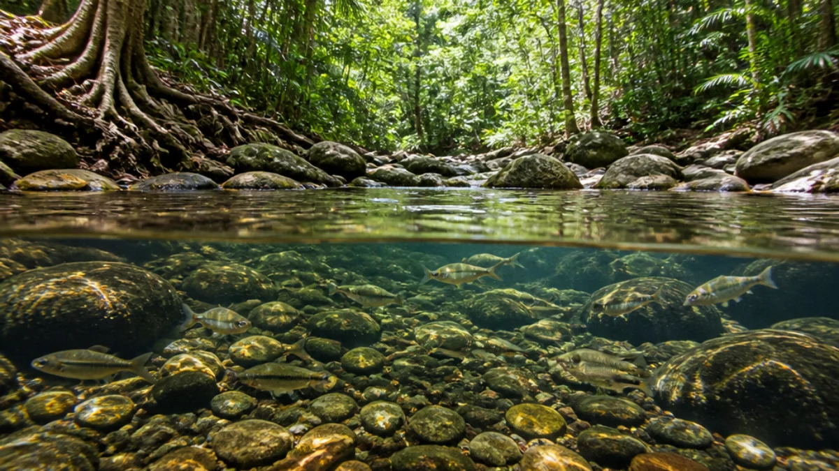
Nei torrenti dei Wet Tropics australiani, l’aumento della temperatura e il degrado della vegetazione ripariale possono amplificare la pressione su specie rare e localizzate. Immagine illustrativa generata con intelligenza artificiale.

Il riscaldamento dell’acqua diventa particolarmente importante quando la vegetazione lungo le rive viene ridotta o sostituita. Gli alberi ripariali contribuiscono a mantenere l’ombra e a limitare l’esposizione diretta dei piccoli torrenti; quando questa protezione diminuisce, le condizioni fisiche dell’habitat possono cambiare e favorire specie più tolleranti. Nel rapporto, il degrado ambientale è collegato anche all’aumento del rischio di ibridazione per alcune popolazioni di pesci arcobaleno del genere Melanotaenia.
I Wet Tropics sono considerati una delle aree australiane più ricche per la fauna ittica d’acqua dolce. La rete comprende torrenti montani, corsi d’acqua di pianura, zone umide e ambienti collegati agli estuari. Questa varietà sostiene comunità differenti, ma rende evidente anche la dipendenza delle specie da condizioni locali: portata, qualità dell’acqua, struttura del fondale, vegetazione e continuità dei collegamenti possono determinare la presenza o l’assenza di una popolazione.
 journals.plos.org
Background Given the globally poor protection of fresh waters for their intrinsic ecological values, assessments are needed to determine how well fresh waters and supported fish species are incidentally protected within existing terrestrial protected-area networks, and to identify their vulnerability to human-induced disturbances. To date, gaps in data have severely constrained any attempt to explore the representation of fresh waters in tropical regions. Methodology and Results We determined the distribution of fresh waters and fish diversity in the Wet Tropics of Queensland, Australia. We then used distribution data of fresh waters, fish species, human-induced disturbances, and the terrestrial protected-area network to assess the effectiveness of terrestrial protected areas for fresh waters and fish species. We also identified human-induced disturbances likely to influence the effectiveness of freshwater protection and evaluated the vulnerability of fresh waters to these disturbances within and outside protected areas. The representation of fresh waters and fish species in the protected areas of the Wet Tropics is poor: 83% of stream types defined by order, 75% of wetland types, and 89% of fish species have less than 20% of their total Wet Tropics length, area or distribution completely within IUCN category II protected areas. Numerous disturbances affect fresh waters both within and outside of protected areas despite the high level of protection afforded to terrestrial areas in the Wet Tropics (>60% of the region). High-order streams and associated wetlands are influenced by the greatest number of human-induced disturbances and are also the least protected. Thirty-two percent of stream length upstream of protected areas has at least one human-induced disturbance present. Conclusions/Significance We demonstrate the need for greater consideration of explicit protection and off-reserve management for fresh waters and supported biodiversity by showing that, even in a region where terrestrial protection is high, it does not adequately capture fresh waters.
La seconda grande pressione arriva dai pesci introdotti e traslocati. In Australia sono state censite numerose specie esotiche d’acqua dolce stabilizzate, alcune delle quali competono con i pesci nativi per cibo e spazio, predano gli individui più piccoli oppure modificano le condizioni dell’habitat. Nei corsi d’acqua degradati, tilapie e gambusie possono risultare più resistenti di molte specie autoctone, aumentando il vantaggio biologico degli invasori proprio dove l’ambiente è già sottoposto a stress.
La perdita di habitat non coincide soltanto con la scomparsa fisica di un torrente. Può riguardare il taglio della vegetazione ripariale, l’aumento dei sedimenti, la semplificazione del fondale, la presenza di barriere e la riduzione della qualità dell’acqua. Anche le piante acquatiche invasive possono alterare la circolazione, aumentare il deposito di materiale organico e, in determinate condizioni, ridurre l’ossigeno disponibile. Per i pesci con areali ristretti, la somma di questi effetti riduce i margini di adattamento.
 wettropicswaterways.org.au
The Science behind the Grades How the data is collected for the Wet Tropics Report Card Freshwater basins The nine rivers in the Wet Tropics all flow east to the Great Barrier Reef. They are affected by a range of pressures including urban and agricultural development. The Report Card uses three indices to assess their condition: Water quality Habitat & hydrology Fish Water quality Water quality is important to aquatic ecosystem health, drinking water supply, agricultural use and recreation and cultural activities. The Report Card uses three categories of indicators to assess the condition of water quality: Sediment Nutrients Pesticides back to freshwater back to top Sediment Sediment affects the reef and also freshwater ecosystem health. Levels of sediment are linked to erosion caused by land management practices. INDICATOR Total suspended solids (TSS) is a measure of the small particles in the water. Changing levels of TSS affect the clarity of the water which reduces the light for aquatic plants. It also smothers coral and other marine life and can signify a problem with normal sediment processes of the ecosystem. WHERE Sediments are sampled at the lowest end of the systems before it becomes estuarine. Details of site locations for each basin is provided on the basin’s web page and in the methods technical report. WHEN During the dry season water samples are taken every month but they are taken more frequently (up to hourly) during high flow events in the wet season when water quality characteristics can change rapidly. HOW Water quality samples are collected using either manual grab sampling or automatic samplers. TSS concentrations are analysed in a lab. Annual water quality scores are calculated from monthly data using scheduled water quality guidelines. Nutrients Concentrations of nutrients in freshwaters are affected by land management practices and by point sources such as waste water treatment plants. High levels of nutrients can cause an increase in plants such algae, which smother coral and seagrass. INDICATORS Dissolved inorganic nitrogen (DIN) (eg. from urea) is used as crop fertiliser and in excess it can disturb the balance of aquatic ecosystems eg. by causing some organisms to grow faster such as algae. The Wet Tropics region contributes the highest annual DIN load to the GBR. Filterable reactive phosphorus (FRP): High levels of phosphorus are associated with outbreaks of potentially toxic blue-green algae and blocking light for other aquatic plants. WHERE Nutrients are sampled at the lowest end of the systems before it becomes estuarine. Details of site locations for each basin is provided on the basin’s web page and in the methods technical report. WHEN During the dry season water samples are taken every month but they are taken more frequently (up to hourly) during high flow events in the wet season when water quality characteristics can change rapidly. HOW Water quality samples are collected using either manual grab sampling or automatic samplers. DIN and FRP concentrations are analysed in a lab. Annual water quality scores are calculated from monthly data using scheduled water quality guidelines. Pesticides Pesticides can impact the health of freshwaters and are identified as a risk to the health of the reef. Some forms can persist in the environment for years. INDICATOR Pesticide risk metric: The Report Card currently assesses the risk posed of 22 pesticides to freshwater ecosystems. High concentrations of pesticides can impact on aquatic plants and animals. WHERE Pesticides are sampled at the lowest end of the systems before it becomes estuarine. For basins with pesticide monitoring details of site locations are provided on the basin’s web page and in the methods technical report. WHEN Sampling of pesticides occurs during the wet season when mobilisation and risk to aquatic ecosystems increases with rainfall-runoff events. HOW Water quality samples are collected using either manual grab sampling or automatic samplers. The risks are assessed based on exposure periods and concentrations. Habitat and hydrology This index gives an indication of how land use and development are impacting the health of aquatic systems and communities. Habitat modification Flow Riparian vegetation Wetlands Invasive weeds back to freshwater back to top Habitat modification This refers to physical alterations in waterways (eg scouring or deposition of sediment), which can disrupt ecological processes and species distribution and behaviour. INDICATOR Impoundment length refers to the proportion of a river that has been pooled by construction of dams and weirs. Within the impoundment the water becomes deeper and slower flowing and aquatic plants and animals become more similar to those in a lake and less like the naturally occurring populations. Fish barriers: Waterway barriers, such as causeways and weirs, impact the movement of the many migratory fish of the Wet Tropics. This can affect spawning, feeding and fish numbers. WHERE Anywhere where a weir or dam has been built on a stream. The basin fish barrier indicator is under development. WHEN Every four years HOW GIS and satellite imagery are used to identify and measure impoundment length. Total length of impounded waterways is expressed as a proportion of total waterway length. Flow Flow assesses how closely current flows resemble pre-development flows. Natural water flows are important for waterway health but are affected by changes from urban development and agriculture eg. dams. INDICATORS 10 measures of natural flow (eg. flood frequency and duration) are used to compare current flows with pre-development. Changes in these patterns can disrupt aquatic processes and communities. WHERE Queensland Government flow gauging stations within each basin (some basins have multiple stations). WHEN Every year HOW Measured flow is compared with modelled pre-development flow condition to determine the extent that flow has been impacted. Riparian vegetation Vegetation on the banks of waterways provides important bank and instream habitat. It also affects water quality by stabilising river banks, filtering coarse sediment and moderating water temperature from shading (good for fish). INDICATOR Riparian extent is a measure of the remaining streambank vegetation compared to pre-clearing. Healthy riparian vegetation reduces sediments and nutrients flowing into waterways. This indicator does not assess condition of riparian vegetation. WHERE Entire area of each basin.
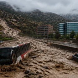
Nel nord tropicale australiano, il rischio non è legato soltanto alle temperature medie. Il rapporto segnala come cambiamenti del regime delle portate e fenomeni estremi, tra cui cicloni, siccità e frane, possano incidere in modo molto elevato su alcune specie. Le piene possono rimaneggiare il substrato e isolare gli habitat, mentre i periodi asciutti possono ridurre rifugi e collegamenti. La risposta varia però da bacino a bacino e dipende dalla capacità del sistema di mantenere aree idonee.
Tra i casi più delicati figurano le popolazioni residue di pesci arcobaleno di Malanda, Utchee Creek e Lake Eacham. Il rischio indicato dagli esperti riguarda l’ibridazione con l’eastern rainbowfish, una specie strettamente imparentata la cui diffusione può essere favorita dal deterioramento dell’habitat e da acque più calde. Non si tratta soltanto di una diminuzione numerica degli individui: la perdita di identità genetica può compromettere caratteristiche evolutive sviluppate in ambienti molto circoscritti.
Un altro esempio riguarda il Bloomfield River cod, esposto a una pressione molto elevata da parte di pesci invasivi o trasferiti in altri bacini. La specie ha un areale ristretto e condivide con gli introdotti preferenze alimentari e ambientali, una combinazione che può aumentare la competizione. Il rapporto sottolinea quindi la necessità di interventi mirati: proteggere il corso d’acqua non basta se, nello stesso tempo, non si limita l’ingresso degli invasori e non si conserva la qualità dell’habitat.
Il quadro locale si inserisce in una crisi più ampia dei pesci d’acqua dolce australiani. Una valutazione nazionale pubblicata nel 2024 ha stimato che il 37% delle 241 specie autoctone esaminate rientra nelle categorie minacciate, vulnerabili o prossime a livelli critici, mentre le pressioni più ricorrenti comprendono specie problematiche, modifiche dei sistemi naturali, cambiamento climatico e condizioni meteorologiche severe. I Wet Tropics mostrano con particolare chiarezza quanto le minacce possano sommarsi nello stesso bacino.
La conservazione dovrà quindi combinare più strumenti. Il monitoraggio delle temperature e delle portate può aiutare a individuare i tratti più vulnerabili, mentre il ripristino della vegetazione ripariale può offrire ombra e maggiore stabilità fisica. Sono inoltre possibili misure di controllo delle specie introdotte, barriere selettive e tutela dei collegamenti tra torrenti, zone umide ed estuari. Le priorità cambiano secondo la specie, ma il principio generale è chiaro: intervenire su una sola minaccia rischia di lasciare intatto il resto della pressione.
Il dato più significativo dello studio è la natura cumulativa del problema. Un piccolo pesce con areale limitato può sopportare una variazione ambientale isolata, ma dispone di meno alternative quando l’acqua si riscalda, la riva perde copertura, arrivano concorrenti e il regime delle portate diventa più irregolare. L’interpretazione più prudente è che il cambiamento climatico agisca spesso come amplificatore di vulnerabilità già presenti, non come causa unica e separata.
Nei prossimi anni sarà importante verificare se le popolazioni più isolate riusciranno a mantenere nuclei riproduttivi stabili e se le specie introdotte continueranno ad avanzare nei bacini ancora relativamente integri. Le proiezioni climatiche richiamate dagli esperti indicano un aumento della frequenza delle giornate molto calde e delle fasi calde prolungate, ma l’effetto concreto sui singoli torrenti dipenderà da quota, ombreggiamento, portata e gestione del territorio. Per questo la sorveglianza dovrà essere locale e continuativa, non limitata a controlli occasionali.
La vicenda dei 22 pesci tropicali mostra infine un limite delle aree protette terrestri: la protezione della foresta non garantisce automaticamente la conservazione dei corsi d’acqua che la attraversano. Servono corridoi fluviali, controllo delle introduzioni, interventi sulle rive e una gestione capace di considerare insieme acqua, clima e biodiversità. Se questi elementi saranno coordinati, alcune popolazioni potranno conservare habitat funzionali; in caso contrario, la perdita potrebbe procedere in modo silenzioso, bacino dopo bacino.